
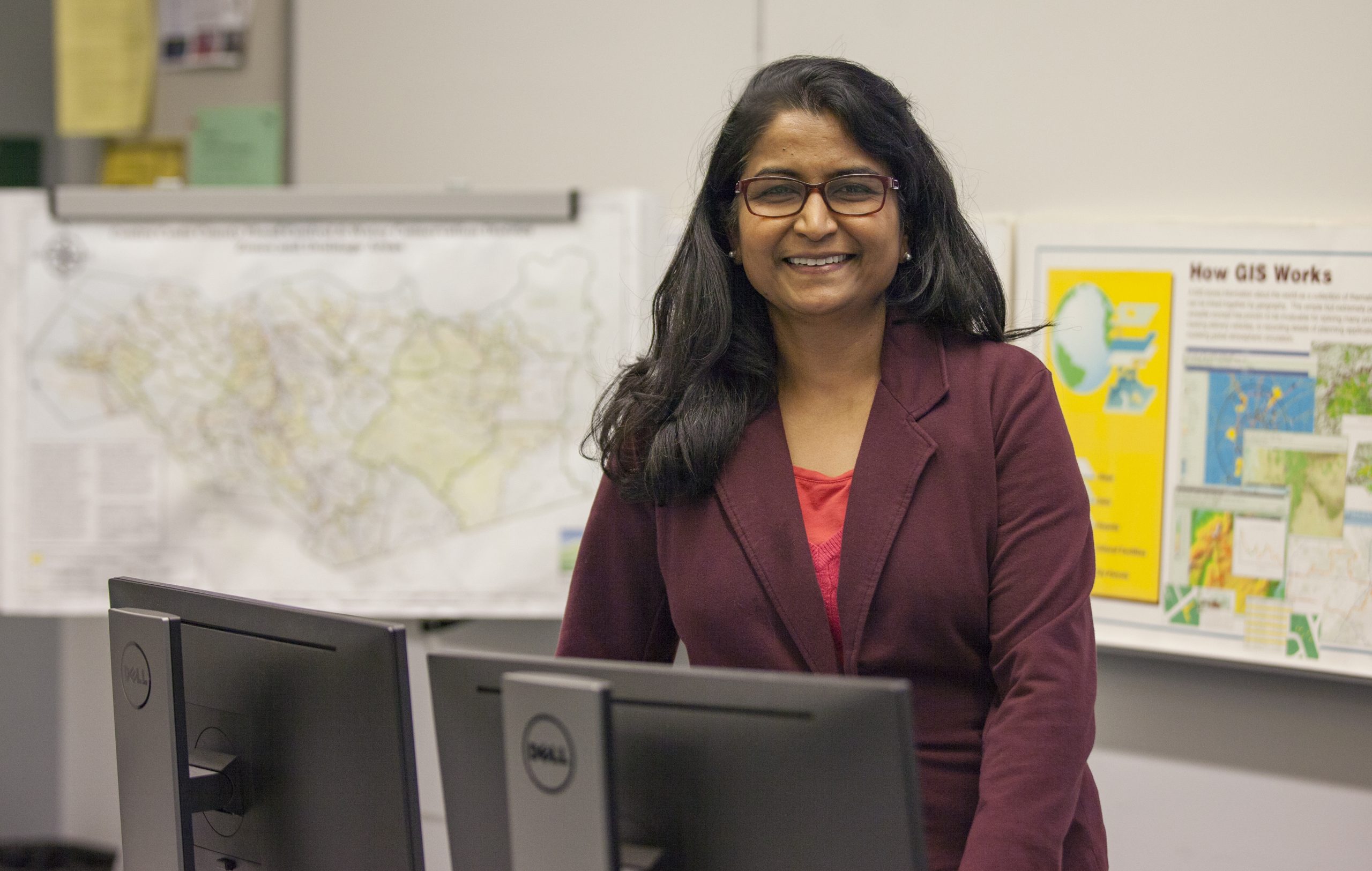
A career change can open doors to unexpected and rewarding opportunities. This is the case with Andrea Jacob and her journey from biological sciences to a successful leadership role in Geographic Information Systems (GIS). After graduating from Cal Poly San Luis Obispo with a bachelor’s degree in biological sciences and a minor in statistics, her initial plans to study the effects of climate change on ocean currents were derailed.
“Unfortunately, I graduated right in the middle of one of the government shutdown hiring freezes. I went into the biotech industry for about four years before I decided that it was not the right fit for me. During that time, I started learning about and working in data management which sparked an interest for me,” said Jacobs. The problem-solving and analytical aspects of managing data resonated with her, hinting at a new direction.

Seeking a more fulfilling career path, Jacobs decided to return to college. With the support of her family, she was able to leave her job to attend DVC full-time. She strategically chose a combination of GIS and computer science classes, ultimately graduating with an associate in science degree in computer science. She also earned a certificate in GIS from San Francisco State University.
Jacobs credits her time at DVC, particularly the strong foundation provided by its GIS/GPS program, as instrumental in her career transition. “I learned about an internship opportunity with the City of Concord through the GIS/GPS program, enabling me to take the skills I was learning in class and apply them to projects with the city.”
That initial internship with the City of Concord proved to be a significant turning point for Jacobs, providing valuable opportunities to connect with staff and supervisors across various city departments. This experience led to a permanent position as the city’s GIS Analyst, a role that then paved the way for her promotion to GIS Manager for the City of Concord. As GIS Manager, Jacobs plays a vital role in managing the integration of geographic data with other city applications and producing essential GIS products for the city’s customers.
“We maintain publicly available web maps and downloadable data, and create map exhibits for projects that are presented to the City Council and the public,” said Jacobs. These exhibits might include visual representations of proposed zoning changes or interactive maps showcasing local infrastructure improvements.
Jacobs emphasizes the dynamic and expanding nature of the GIS field, offering diverse career paths. “I’ve met people in all different types of industries that interact with GIS. The skills apply to so many careers,” said Jacobs, highlighting the increasing need for professionals who can analyze and visualize spatial data to support informed decision-making.
Navigating from Arizona Back to the East Bay for a New Future

“I attended Carondelet High School in Concord, where the curriculum was highly focused on getting students onto early paths into traditional 4-year colleges and universities. I chose to go to college out of state and enrolled at the University of Arizona,” said Morgan March.
March majored in psychology at the University of Arizona and pursued two minors – family studies and human development, and anthropology. She left school during her third year, choosing to work full-time at a plasma donation center. When reflecting on her time in Arizona, she notes that her favorite courses were part of her anthropology minor.
“In retrospect, my affinity to earth, physical anthropology, and biological sciences stands out markedly from my other courses,” said March.
Upon returning home, March forged a new academic path at DVC. She changed her field of study to geography to immerse herself in subjects that truly captivated her. She found her academic footing, earning her associate in science for transfer in geography and a certificate of accomplishment in geographic information systems/global positioning systems (GIS/GPS). After transferring to Cal State East Bay, March finally earned her long-sought bachelor’s degree.
“Moving out-of-state, fresh slate, newfound freedom. I did not apply myself fully, as I had plenty of fun distractions, severe imposter syndrome and self-doubt,” said March.
Reflecting on her journey, March feels relieved that she found her niche. While she sometimes felt left behind, she says that there is little she would change if given the opportunity.
Dr. Binita Sinha, the program lead for the GIS/GPS program at DVC, emphasizes how deeply geospatial technology is woven into our daily lives. While many recognize its role in smartphone navigation, GIS/GPS technology has many more applications.
“In marketing, for example, geospatial technology is used in conjunction with geofencing and geotagging, where you receive a targeted advertisement based on where you are at that moment. And then the bigger picture – there are places that people can’t go, but drones can, such as wildfires and military operations,” said Sinha.
Like Jacobs, March directly credits the DVC GIS/GPS program with helping her secure an internship with her current employer, Contra Costa County. Sinha recognized March’s potential and recommended her to the hiring manager.
“Since that time, I’ve worked my way from intern to technician and am now a GIS Analyst at the Department of Information Technology for Contra Costa County,” said March.
As a GIS Analyst, March plays a key role in managing the county’s ArcGIS Enterprise platform. She also specializes in cartographic design, creating visually effective maps using geographic information science and design principles.
For students seeking diverse career options, the Certificate of Achievement in GIS/GPS at DVC provides an excellent foundation. This 27-unit program combines coursework in GIS, computer science, biological science, and geology, equipping students with a well-rounded skillset.
“GIS is a widely applicable field of study that has some of the most interesting people I’ve ever networked with. Spatial critical thinking and analysis are valuable skills to have, even if just a compliment to your wider interests and goals,” said March.
The program also caters to students interested in the burgeoning intersection of artificial intelligence and geographic data. “Geospatial AI (GeoAI) is a growing technology that is beneficial for model building, as well as data identification, extraction, and classification. Becoming familiar with the technology and utilizing it in workflows are essential skill sets to gain as AI becomes a more prominent and integrated technology,” said March.
Mapping Your Future: GIS/GPS and Drone Technology at DVC
The degree and certificate programs in Geographic Information Systems (GIS) and Global Positioning Systems (GPS) at DVC are specifically designed to prepare students for a wide array of careers. Whether pursuing general applications or specialized roles, these programs provide a strong understanding of GIS as a versatile system that captures, stores, manages, analyzes, and displays geographic data. From government agencies to businesses in planning, architecture, forestry, and geology, GIS skills are in high demand across numerous sectors.
Recognizing the increasing importance of aerial data, DVC also offers certificates in drone technology. These programs prepare students to pass the Federal Aviation Administration Part 107 commercial drone pilot exam and launch careers in drone piloting, data acquisition, and data processing. This complementary field further expands the opportunities for students interested in geospatial technologies.
Degrees and Certificates
- Associate in Arts for Transfer – Geography
- Associate in Science – Geographic Information Systems/ Global Positioning System
- Certificate of Achievement – Drone Technology
- Certificate of Achievement – Geographic Information Systems/ Global Positioning System
- Certificate of Accomplishment – Drone Technology Fundamentals
- Certificate of Accomplishment – Geographic Information Systems/ Global Positioning System
For more information about GIS/GPS and drone technology programs at DVC, visit: www.dvc.edu/geography
Understanding GIS & GPS
GPS (Global Positioning System) technology tells you where things are on Earth, like your phone’s map app shows your location.
GIS (Geographic Information Systems) is like a super-powered digital map that combines layered data with locations on a digital map to reveal patterns that lead to better decision-making.
Bay Area Job Outlook
GIS/GPS skills are valuable in careers that require expertise in knowing where things are and understanding information connected to those locations. Opportunities include:
Environmental Technician
San Francisco/East Bay Average Salary: $84,620
Survey Technician
San Francisco/East Bay Average Salary: $78,700
Mapping Technician
San Francisco/East Bay Average Salary: $78,700
GIS Analyst
San Francisco/East Bay Average Salary: $134,060
Emergency Management Specialist
San Francisco/East Bay Average Salary: $161,160
Source: